


HOME
The "Limestone Barrens" of the west coast of the Island of Newfoundland, Canada, constitute an ECOSYSTEM AT RISK. Geographically, they occupy two primary areas:
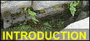
 "Northern Limestone Barrens". Boat Harbour. Photo: John E. Maunder. [CLICK image to enlarge.] 2. The "Southern Limestone Barrens" - A more compact area [map] comprising the summit of Table Mountain, west of Stephenville, and several exposed sections of the nearby Port au Port Peninsula [on map "limestone barrens" are shown in RED].  "Southern Limestone Barrens". Between Cape St. George and Mainland, Port au Port Peninsula. Photo: John E. Maunder. [CLICK image to enlarge.]  "Southern Limestone Barrens". Table Mountain (= "Pinetree") near Port au Port. Photo: Michael Burzynski. [CLICK image to enlarge.] Chemically, they are underlain by both limestone and dolomite bedrock of Cambrian and Ordovician age. Ecologically, they are consistently subjected to challenging climatic conditions; in general because of their exposed barren aspect, but, more specifically, towards the north, because of increasingly colder conditions. Biologically, they harbour a rich and unique flora and fauna. Anthropologically, they tend to occur in close proximity to human habitation, and are therefore subject to the many dangers of this close association. Smaller "Limestone Occurrences" within the Province. Numerous, additional, smaller, coastal cliffs and screes, outcrops, bare patches, and marls of limestone and/or dolomite, of varying geological age, occur primarily in the western and central portions of the Island, on Belle Isle, in the Strait of Belle Isle region of southern Labrador (and adjacent Quťbec), and in central and northern Labrador. Arguably not worthy of the grander name "limestone barrens", these smaller occurrences nevertheless support many extremely important elements of the overall "limestone flora and fauna" of Newfoundland and Labrador.  Tucker's Head, near Lomond, Bonne Bay. "Limestone" scree slope. Photo: Michael Burzynski. [CLICK image to enlarge.]  Raglan Head, Bay of Islands. The top of the huge "limestone" scree slope. Claudia Hanel, Carson Wentzell, and John Maunder, looking for "limestone" plants, including Yellow Mountain Avens (Dryas drummondii). Photo: Nathalie Djan-Chťkar. [CLICK image to enlarge.]  Mt. Patricia = Breakfast Head = Hanna's Head = "Old Man in the Mountain". Humber Gorge. "Limestone" cliffs and scree slopes. 2005. Primary Newfoundland locality for the Provincially very rare "limestone plant", the Cutleaf Fleabane (Erigeron compositus). Photo: Dan/Pat Montague. [CLICK image to enlarge.]  Cow Head Peninsula. Limestone breccia outcrop. Photographing White Mountain Saxifrage Saxifraga paniculata subsp. laestadii. 2008. Photo: Michael Burzynski. [CLICK image to enlarge.]  L'Anse-Amour, Labrador Strait. "Limestone" outcrop and vegetated scree slope. 2008. Home to a peculiar creamy-white-flowered form of Robbin's Milkvetch (Astragalus robbinsii). Photo: Susan Maunder. [CLICK image to enlarge.]  North Twillingate Island, below Long Point Lighthouse. 2006. Area of significant "limestone" outcrops, and "limestone" plant occurrences. Photo: Carl Munden. [CLICK image to enlarge.]  Exploits River. Grand Falls, just south of the old paper mill. Area of "limestone" outcrops. 2008. Photo: John E. Maunder. [CLICK image to enlarge.]  Marl pond just west of Corner Brook. Calcareous mud and rocks. Photo: John E. Maunder. [CLICK image to enlarge.] [Page last updated: November 13, 2021] |